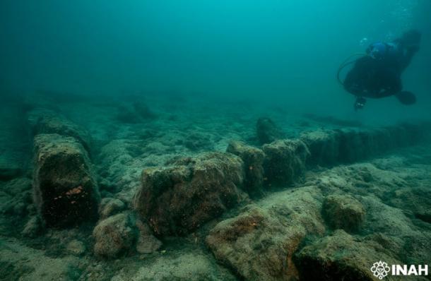
In the placid waters of Central America’s deepest lake, an international team of scientists has been engaged in an exciting multi-year research project. Under the authority of Mexico’s National Anthropology and History Museum (INAH), they’ve been exploring, mapping, and photographing the remains of an ancient Maya city known as Samabaj, which is submerged 55 feet (16.7 meters) beneath the surface of mountain-sheltered Lake Atitlán, Guatemala’s top tourist attraction .
The most recent dives at Samabaj were led by the INAH consultant Helena Barbra Meinecke, who heads that organization’s Yucatan Peninsula underwater archaeology sub-directorate. The ongoing exploration project, which was launched in 2017 , also has the full support and cooperation of UNESCO’s Scientific and Technical Advisory Body (STAB). Underwater archaeologists from Mexico, Guatemala, Belgium, Spain, France, and Argentina have participated in dives over the years, and the underwater city has now been extensively explored and mapped as a result of these efforts.

Part of submerged Maya city in Lake Atitlán, in Guatemala. ( INAH)
The Creation and Destruction of Lake Atitlán and Samabaj
The city of Samabaj was built and occupied sometime during the Maya Late Preclassical Era, which lasted from 400 BC to 250 AD. The city was a fully developed and densely occupied settlement that featured all the structures associated with Maya urban and spiritual culture , including temples, square plazas, stone stelae and monuments, and domestic housing.
In addition to actual dives, the scientists involved in this project have been using remote sensing technology to generate more precise data about the underwater structures that remain standing in Samabaj. This type of data has helped researchers create what is known as a planimetric map, which can reveal an ancient site’s true size and dimensions.
“With this planimetry we can talk about a site that measures at least 200 by 300 meters [650 by 980 feet],” Helena Barba Meinecke stated, in a press bulletin released by INAH.
Amazingly, Samabaj was not constructed along the shore of Lake Atitlán, only to later be flooded when water levels rose. It was instead built on a small island that once broke through the surface of the expansive lake, providing just enough land area to build a Maya city.
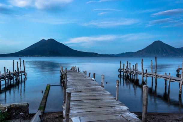
Lake Atitlán was formed in the crater of a volcano that exploded in a massive eruption 84,000 years ago. It currently covers 50 square miles (130 square kilometers) of surface area and reaches a depth of 1,120 feet (340 meters).

Peaceful landscape of a sunrise at the docks of Panajachel, Lake Atitlán, Guatemala. ( Mltz/Adobe Stock)
Its dimensions might have been somewhat different in the past, however, as scientists believe another highly impactful volcanic event took place in the region approximately 2,000 years ago, give or take a few centuries. This event caused seismic disturbances in the lakebed, which caused water levels to rise rapidly and dramatically. As a result of this calamity the entire island upon which Samabaj sat would have disappeared beneath the lake’s surface, forcing hundreds or perhaps thousands of people to evacuate as quickly as possible.
While the city they left behind was abandoned forever, the deep, cool waters of Lake Atitlán have helped keep its remains in pristine condition, much to the delight of the underwater archaeologists who’ve been studying the site so intently.

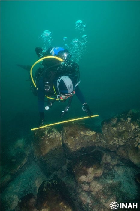
Underwater archaeologist inspecting a remaining wall of the submerged Maya city of Samabaj, in Lake Atitlán, in Guatemala. ( INAH)
Who Built Samabaj?
Samabaj was concentrated in a relatively small area. Nevertheless, the people who constructed this condensed city made sure to include all the features normally associated with a Maya settlement.
At this point, the researchers cannot say with certainty which Maya group built this particular urban complex. But they do have two obvious candidates.
The people living near the lake 2,000 years ago belonged primarily to two groups of Maya people, the Tz’utujil and the Kaqchikel. The latter have come to be viewed as rather treacherous historical actors, because they chose to ally themselves with the European invaders during the 16th century Spanish Conquest . They did so to gain Spanish support in their latest wars against their sworn enemies, the Tz’utujil and K’iche’ Maya.
Unsurprisingly, the duplicity of the Kaqchikel did not result a happy ending. The betrayers of their Maya neighbors were themselves betrayed and ultimately conquered by the Spanish, who weren’t interested in sharing power or wealth with the native population.
The Next Best Thing to Being There
Explorations at the underwater Lake Atitlán site will continue in future seasons. But INAH plans to transfer responsibility for the project to Guatemalan underwater archaeologists. Security is being provided by the inhabitants of the lakeside village of Santiago Atitlán, who’ve promised to stop unauthorized divers from plundering or vandalizing the site.
In the meantime, the public will soon have a chance to pay a virtual visit to Samabaj, to see what it would have looked like at the time it was built.
In cooperation with Fundación Albenga, an Argentina-based underwater archaeology organization, and the Lake Museum in Atitlán, the government of Guatemala has approved a new project known as “Underwater archaeology in the Lake Atitlán. Samabaj 2003 Guatemala.” This project will culminate in the creation of a cultural center, where visitors will be able to tour a vivid digital reconstruction of the city that sunk beneath the waters of Lake Atitlán approximately 2,000 years ago.
Top image: INAH collaborates in the exploration of a submerged Maya city in Lake Atitlán, in Guatemala. Source: INAH
By Nathan Falde
Related posts:
Views: 0
 RSS Feed


 April 6th, 2022
  Awake Goy
  Posted in
  Tags:
Tags: 


