Eleven days after tar began to wash up on Israel’s Mediterranean shore, apparently as a result of a marine oil spill, the Environmental Protection Ministry on Monday called on companies specializing in mapping and cleaning up of the marine environment to help local authorities find ways of getting the tar off hard, rocky surfaces, under the supervision of marine ecology inspectors.
The call came as reports came in of more tar washing up onto beaches at Tel Dor, north Netanya, Emek Hefer, Gador, Michmoret, Nachsholim and Beit Yannai in the north and Nitzanim in the south.
The ministry said it was looking, together with the Israel Nature and Parks Authority, at all potential solutions for getting the tar off rocky surfaces without damaging marine wildlife.
Specifically, the ministry wants help with mapping the contaminated areas along the coast and determining policy and priorities for treatment (together with a marine ecologist), as well as identifying the right equipment, personnel and materials with which to clean the rocks. Further details are available (in Hebrew) on the ministry website.

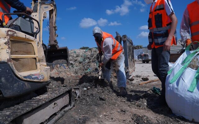
Removing tar from the Atlit beach in northern Israel, March 1, 2021, (Elad Yaakov, Government Press Office)
It has proven far harder to clean the rocks than the sand.
Even so, on Sunday, the INPA said it had reached the conclusion that it would not be possible to completely rid the sand of tar either.
The ministry is cooperating with the Israel Defense Forces and various international organizations to try to pinpoint the ship or ships responsible for the spill.
It identified indications of an oil spill on February 11, 44 kilometers (28 miles) west of Israel’s coast. The satellite image showing this slick was published Sunday by the environmental organization Greenpeace.
However, no information has been made public regarding the substance that was leaked, or the ships that have come under suspicion. On Sunday, a Greek tanker, the Minerva Helen, was eliminated after inspectors boarded the vessel in the Greek port of Piraeus.
The ministry has said that it is looking at dozens of vessels that were in the area during the period that the suspected leak occurred.
On Saturday, the Financial Times published two graphics showing the paths of 210 vessels that passed within 50 kilometers of the coasts of Israel and Lebanon between February 10 and 12.
The graphics illustrate the high volume of traffic that crisscrosses the Eastern Mediterranean.
The oil spill in the east Med washed tonnes of tar on to the coast of Israel and Lebanon, devastating sea life. We mapped the routes of all vessels in the region during the relevant period, huge thanks to @VesselsValue for the datahttps://t.co/BhZQ7zdPsT#gistribe #OILSpill pic.twitter.com/hOsd1jJfRg
— Steven Bernard (@sdbernard) February 27, 2021
I made an animated version for this week’s @FinancialTimes climate graphic. Wouldn’t have been possible without the @qgis temporal controller. Pleased I got the fading effect to work too. And huge thanks to @nyalldawson for ironing out some glitches for mehttps://t.co/BhZQ7zdPsT pic.twitter.com/5TYUiMujce
— Steven Bernard (@sdbernard) February 27, 2021
On Sunday, the ministry also announced that following aerial surveys carried out by the army, nothing had been found of a suspected spill identified Thursday some 150 kilometers (93 miles) from Israel’s shores.
“It must be remembered that most of the identifications coming from satellite images are false-positive,” the ministry said. “The satellite picks up disturbances but in most cases the cause isn’t oil. The satellite picks up anomalies of various types that can resemble an oil slick, such as temperature difference, water discharged by passing ships that is not against any law, hovercraft, seaweed mixed with particles floating in the water, algae blooms and differences of depth.”
Related posts:
Views: 0
 RSS Feed


 March 1st, 2021
  Awake Goy
  Posted in
  Tags:
Tags: 


